Outputs
Since the BioDAR Team first came together in 2016, there have been a lot of conversations, a lot of coding sessions, and a lot of exciting findings. The grants, fellowships, and PhD studentships that have resulted from that initial conversation have borne a variety of fruits. You can find out more below:
Journal articles
Matthews, T., R. R. Neely III, V. Melnikov and C. Hassall (2025). Taxonomic resolution in dual-polarization weather radar observations of biological scatterers: A systematic review. Ecosphere 16(10): e70419. https://doi.org/10.1002/ecs2.70419

Mungee, M., M. Lukach, C. Shortall, J. R. Bell, E. J. Duncan, F. I. Addison, L. E. Brown, W. E. Kunin, C. Hassall and R. R. Neely III (2025). Spatio-Temporal Variation in Aerial Arthropod Abundance Revealed by Weather Radars. Global Change Biology 31(10): e70425. https://doi.org/10.1111/gcb.70425.
Featured in the Guardian, BBC, Yorkshire Post, myScience, ExBulletin, Phys.org, Tribune International, AOL, Yahoo!News, and Earth.com.


Lukach, M., Dally, T.M., Evans, W., Duncan, E.J., Bennett, L., Addison, F.I., Chapman, J.W., Neely, R.R., Hassall, C. (2024) Operationalising weather surveillance radar data for use in ecological research, Ecological Informatics, 84: 102901. https://doi.org/10.1016/j.ecoinf.2024.102901


Hodges, S., Hassall, C., & Neely, R.R., III. (2024). Weather radars reveal environmental conditions for high altitude insect movement through the aerosphere. Remote Sensing, 16(23), 4388. https://doi.org/10.3390/rs16234388
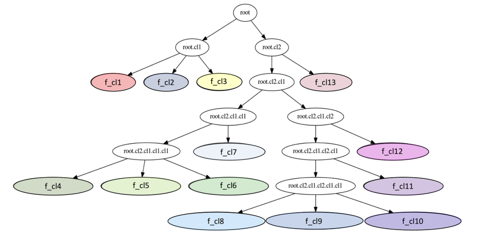
Lukach, M., Dally, T., Evans, W., Hassall, C., Duncan, E.J., Bennett, L., Addison, F.I., Kunin, W.E., Chapman, J.W. and Neely, R.R., III (2022), The development of an unsupervised hierarchical clustering analysis of dual-polarization weather surveillance radar observations to assess nocturnal insect abundance and diversity. Remote Sens Ecol Conserv, 8: 698-716. https://doi.org/10.1002/rse2.270
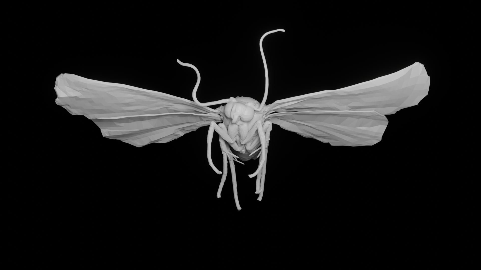
Addison, F.I.; Dally, T.; Duncan, E.J.; Rouse, J.; Evans, W.L.; Hassall, C.; Neely, R.R., III. (2022) Simulation of the Radar Cross Section of a Noctuid Moth. Remote Sens. 14, 1494. https://doi.org/10.3390/rs14061494

Lukach, M., Dufton, D., Crosier, J., Hampton, J. M., Bennett, L., and Neely III, R. R. (2021) Hydrometeor classification of quasi-vertical profiles of polarimetric radar measurements using a top-down iterative hierarchical clustering method, Atmos. Meas. Tech., 14, 1075–1098, https://doi.org/10.5194/amt-14-1075-2021.
Other outputs
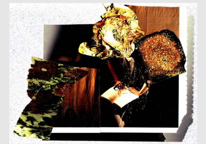
Weather, Whether Radar: Plume of the Volants (Redell Olsen)
Redell Olsen joined the BioDAR Project through a DARE Art Prize Fellowship and has been working with the group for a couple of years. Dell produced the second output out of the BioDAR collaboration: this fantastic virtual exhibition of spoken word, music, visual art, and poetry that were inspired by insects and radar. More details can be found at https://weatherwhetherradar.art/

Aeroecology: Exploring Biodiversity with Radar (Online Course)
Radar ecology is a field that we have been working in for several years but is still a relatively niche area (albeit with considerable potential!). As part of a Natural Environment Research Council project, we received funding to create an online course to promote the field. That course launched through Coursera in November 2022. You can sign up here: https://www.coursera.org/learn/aeroecology-exploring-biodiversity-with-radar
